Enhanced maritime picture via Integrated Maritime Services (IMS) for Member States

Member State authorities are at the heart of EMSA’s Integrated Maritime Services (IMS).
The IMS for Member States service combines maritime data from different reporting/tracking and surveillance systems to provide a comprehensive maritime picture, while addressing common monitoring needs.
The services support operational users in a variety of functions and domains, including maritime safety and security, environmental monitoring, border control, defence, fisheries monitoring, search and rescue, law enforcement, port state control, and accident investigation.
Services are offered to all Member State authorities executing coast guard functions in the maritime domain. The provision of services follows a functional approach, i.e., regardless of the governmental department/authority in which users are based e.g., maritime, environment, transport, defence, etc., if they have been allocated responsibilities which necessitate and justify the use of maritime data, this data is provided by EMSA following the agreed access rights.
The IMS service for Member States is based on position information as well as satellite data and images, and responds to operational users’ specific needs, providing additional, complementary, and supportive tools and functionalities.
Taken as a whole, the IMS array of services supports the activities performed by EU Member State authorities executing functions in the maritime domain.
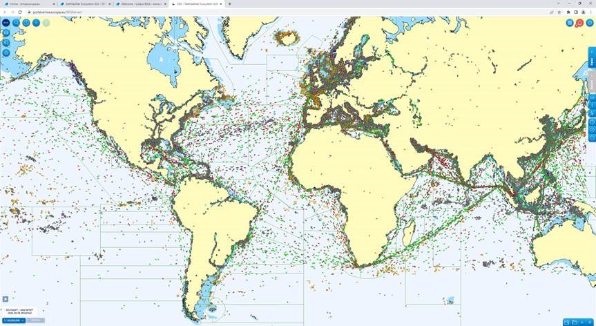 The maritime picture on a worldwide scale - screenshot from the IMS graphical interface (SEG)


Relevant Publications - Digitalisation

Related Items - Integrated Maritime Services

