Copernicus Maritime Surveillance Service
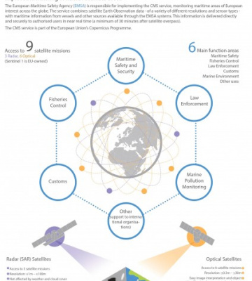
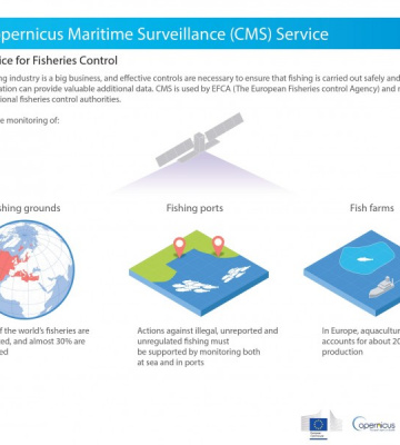
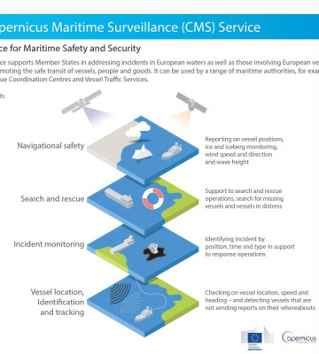
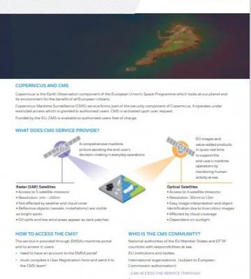
The Copernicus Maritime Surveillance (CMS) Service provides Earth Observation products (satellite images and value adding products) to support a better understanding and improved monitoring of activities at sea, within a wide range of operational functions such as maritime safety, maritime security, customs, law enforcement, marine pollution monitoring, fisheries control and international cooperation. Implemented by EMSA, it is a Security Service of Copernicus .
Copernicus is the Earth Observation component of the European Union’s Space Programme which looks at our planet and its environment for the benefit of all European citizens. It offers information services that draw from satellite Earth Observation and in-situ (non-space) data. The European Maritime Safety Agency (EMSA) is the Entrusted Entity responsible for implementing the Copernicus Maritime Surveillance service on behalf of the European Commission (DG-DEFIS).
Recognising that human activity at sea is intrinsically dynamic, the Copernicus Maritime Surveillance Service aims to provide timely, relevant, and targeted satellite-based information to member states and EU bodies. Data from earth observation satellites is combined with a wide range of other data, both from EMSA systems as well as from external sources. This includes vessel identification and position information, behaviour patterns, and intelligence from users. The fusion of data provides a more complete overview of activities at sea, enabling a more in-depth analysis than any one data source alone. By offering increased access to earth observation data, Copernicus reinforces and enhances existing EMSA services and opens the possibility of setting up new services too.
The type of EO data (Synthetic Aperture Radar (SAR) or optical) which is most useful depends on the type of monitoring needed in any given maritime security operation at sea.
Recently Published - Copernicus Maritime Surveillance Service


Featured Copernicus & CleanSeaNet Publications
Recently Published - Infographics